Direct Inventory of Roads and Treatment (DIRT)
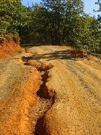
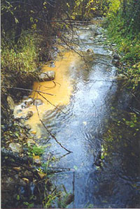
 It is commonly recognized that erosion and migration barrier problems associated with road systems represent a threat to salmonid population recovery. Roads modify natural hillslope drainage networks and accelerate erosion processes. This can have biological consequences that affect virtually all components of stream ecosystems (Furniss et al. 1991)*. However, road systems are one of the most easily controlled sources of sediment production and delivery to stream channels. Within the Five Counties, there are 4,790 miles of County roads and approximately 16,600 culverts. 5C has committed to a long-term, systematic, prioritization-based, sediment reduction program on County roads to improve the quality of water and salmonid habitat. It is commonly recognized that erosion and migration barrier problems associated with road systems represent a threat to salmonid population recovery. Roads modify natural hillslope drainage networks and accelerate erosion processes. This can have biological consequences that affect virtually all components of stream ecosystems (Furniss et al. 1991)*. However, road systems are one of the most easily controlled sources of sediment production and delivery to stream channels. Within the Five Counties, there are 4,790 miles of County roads and approximately 16,600 culverts. 5C has committed to a long-term, systematic, prioritization-based, sediment reduction program on County roads to improve the quality of water and salmonid habitat. The 5C Program has performed road erosion inventories to document road related sediment sources in Del Norte, Humboldt, Mendocino, Siskiyou, and Trinity Counties under numerous grant sources including SB 271, Proposition 204 and the CDFW (formerly CDFG) Fisheries Restoration Grant Program.
The goals of the 5C road erosion inventories are to: identify specific sites along county roads and facilities that are contributing sediment to waterways; prioritize implementation treatments to assure economic, biological, management, and physical effectiveness; and identify sites where excess material (spoils) generated from construction and maintenance projects can be stored with minimal potential for sediment delivery into watercourses.
 Methodology: The Pacific Watershed Associates (PWA) protocols for forest and ranch road inventories were modified for use on County roads and standards in order to develop the 5C's Direct Inventory of Roads and Treatments (DIRT). The PWA model was modified to reflect the differences between private forest and ranch roads and public roads. PWA completes an intensive field-training program for all crew members and is responsible for quality assurance and control (QA/QC) of assessments and data collection. Methodology: The Pacific Watershed Associates (PWA) protocols for forest and ranch road inventories were modified for use on County roads and standards in order to develop the 5C's Direct Inventory of Roads and Treatments (DIRT). The PWA model was modified to reflect the differences between private forest and ranch roads and public roads. PWA completes an intensive field-training program for all crew members and is responsible for quality assurance and control (QA/QC) of assessments and data collection.
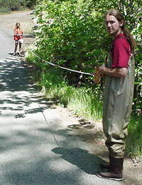
For the field inventory, field technicians visit each site and enter data (i.e., physical characteristics) into the DIRT database. Data are then processed by the program to provide specific figures on how much erosion can be produced - both chronically in one year and episodically during a major storm or event - by that particular site. Other considerations, such as whether a site is a fish migration barrier are also noted. The field technician then prescribes specific treatments to fix the site and recommends a level of immediacy. Major factors considered in the field-based prioritization process include treatment immediacy, erosion activity, total potential sediment yield, complexity, and estimated effectiveness of treatments. For spoils disposal sites, size, ownership, and suitability are recorded. All inventory sites are located using map coordinates and GPS points and regularly downloaded into an ArcGIS platform.
Final prioritization is based on various factors obtained directly from DIRT -- treatment immediacy, potential sediment delivery volumes, and likelihood of delivery to a stream – and factors not entered into the DIRT database: biological considerations of anadromous salmonids (habitat quality and quantity), current water quality violations, TMDL criteria, cost effectiveness, scheduling of county capitol improvement and maintenance projects, management, public input, complexity and design, and other professional considerations. These factors are weighed according to a Simplified Prioritization Ranking Model for final prioritization. Projects are implemented according to each County's available resources and priorities.
 Results: To date, more than 2,455 miles of County roads have been inventoried in Del Norte, Humboldt, Mendocino, Siskiyou and Trinity Counties under several grant sources: California Department of Fish and Wildlife's Fisheries Restoration Program, State Water Resources Control Board's Proposition 204, and the Trinity County Transportation Commission. The most recent inventory, of the Scott and Salmon River watersheds, completed in March 2008 examined 342 miles of County maintained roads in Siskiyou County for potential sediment sources. Results: To date, more than 2,455 miles of County roads have been inventoried in Del Norte, Humboldt, Mendocino, Siskiyou and Trinity Counties under several grant sources: California Department of Fish and Wildlife's Fisheries Restoration Program, State Water Resources Control Board's Proposition 204, and the Trinity County Transportation Commission. The most recent inventory, of the Scott and Salmon River watersheds, completed in March 2008 examined 342 miles of County maintained roads in Siskiyou County for potential sediment sources.
Overall, the inventoried roads have been estimated to produce potentially 6 million yd3 of sediment delivery to streams over a ten year period. The majority of this delivery comes from deficient stream crossings. The 5C Roads Sediment Reduction Program is a direct result of the DIRT inventory and is in full implementation phase. Seventeen projects have been completed, minimizing or preventing approximately 111,604 cubic yards of potential sediment delivery to a stream. Additional implementation proposals have been and will continue to be submitted for funding. DIRT results have proven especially valuable to County Road Departments as over 600 maintenance activity sites have been highlighted during the inventory and can be treated immediately to reduce sediment potential.
Read About Completed Inventories in the Following Final Reports:
For more Information contact us.
Back to Programs Page
|
