Sediment Reduction and Water Quality Improvement Program
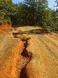
 As part if its goal to improve water quality and enhance salmonid habitat, the 5C has committed to a long-term, systematic, prioritization-based, sediment reduction program. It consists of: 1) identification of sources of sediment delivery to streams from county roads and facilities; 2) prescription of treatments to minimize potential sediment delivery; 3) prioritization of sites for treatment; and 4) improvement of road maintenance policies to reduce and/or prevent adverse impacts to water quality and stream habitat. As part if its goal to improve water quality and enhance salmonid habitat, the 5C has committed to a long-term, systematic, prioritization-based, sediment reduction program. It consists of: 1) identification of sources of sediment delivery to streams from county roads and facilities; 2) prescription of treatments to minimize potential sediment delivery; 3) prioritization of sites for treatment; and 4) improvement of road maintenance policies to reduce and/or prevent adverse impacts to water quality and stream habitat. One of the elements of the 5C sediment reduction program currently underway is to treat county roads and to avoid detrimental impacts to local streams. Development of sediment reduction projects begins with an inventory of county roads to identify and assess sites for potential sediment delivery to streams and prospective spoil disposal areas. Based on inventories completed to date, it is estimated that nearly 6 million yd3 of potential sediment from county roads could be delivered to streams within the 5C region during a 25 year storm event. The 5C developed a Microsoft Access database, known as the Direct Inventory of Roads and Treatments (DIRT), based upon Pacific Watershed Associates’ road erosion inventory methodology modified for use on county roads. DIRT is used in the field to: provide specific figures on how much erosion can be produced by individual sites; record treatments prescribed by trained surveyors for each site; map problem sites with GIS; identify maintenance needs; facilitate prioritization of sediment reduction projects; document photo-point monitoring; and track the progress of individual projects. Ideal spoils disposal sites are: not likely to deliver sediment to streams; not in sensitive archaeological areas; and not likely to adversely impact threatened or endangered plant and wildlife species. Identification of suitable disposal sites benefits local departments of transportation and decreases the likelihood of spoils entering streams.
Final prioritization considers additional factors such as: cost; management: workloads, financial resources, and maintenance and capital improvement plans of local transportation departments; biological factors (i.e., fish passage); regulatory (i.e., water quality violations); TMDL allocation and implementation plans; and project complexity (i.e., permitting and design). A conceptual model has been developed to more easily organize these factors into one ranking system. Based on these results, the 5C seeks funding to help implement individual sediment reduction projects.
All public works projects utilize BMPs outlined in “A Water Quality and Stream Habitat Protection Manual for County Road Maintenance in Northwestern California Watersheds” (5C, 2002). The road manual was developed by the 5C in consultation with various state and federal agencies including the North Coast Regional Water Quality Control Board, California Department of Fish and Game, and NOAA Fisheries. It is specifically designed to protect and enhance the quality of water and salmonid habitat while maintaining the road system. Road manual BMPs are followed by each road/public works department in capital improvement and restoration projects. BMPs specific to project effectiveness monitoring have been developed for use in tracking projects. For road erosion inventory sites, this information is stored in the DIRT database.
Creation of new and improvement of existing policies, keystone 5C efforts, have major benefits to protecting water quality. Grading ordinances have been completed or are in progress in four of the Five Counties.
Training is integral to the improvement of road maintenance policies. 5C holds annual workshops for Public Works and Departments of Transportation personnel. Topics include: innovative methodologies and technologies used in road maintenance and improvement projects; permitting issues applicable to restoration projects; use of road erosion inventory data; and road maintenance manual implementation and BMPs. These training workshops for county staff have promoted better understanding of and generated more support for restoration efforts.
Addressing Road Sedimentation, A Video Presentation serves as an introduction to road-related erosion its effect on water quality. It presents various approaches that may be used to identify and treat road sediment sources.
Future 5C efforts that will supplement the current sediment reduction program include developing land use incentives for private landowners such as flexible subdivision standards and resource habitat zones to minimize impacts to water quality and stream habitat.
For more information, contact us.
Back to Programs Page
| 