|
Intro to Low Impact Development
What is Low Impact Development?
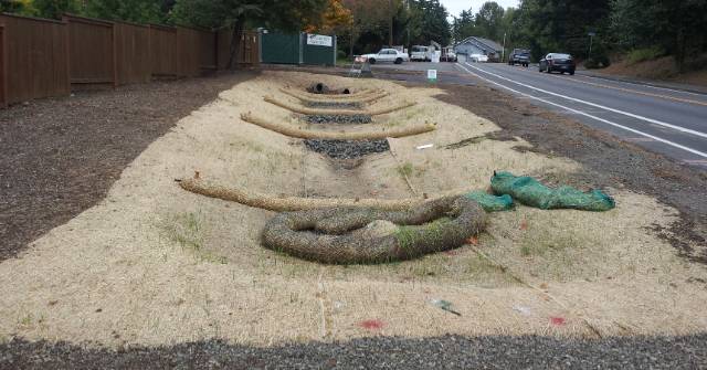
Low Impact Development (LID) is a collection of methods (aka Best Management Practices or BMPs) that preserve natural resources and collect and clean stormwater runoff to protect and improve water quality and
availability. One of the main principles is to simulate natural drainage patterns and incorporate vegetation and
natural materials into stormwater facilities. The Puget Sound Partnership defines LID as "a stormwater and land
use management strategy that strives to mimic pre‐disturbance hydrologic processes of infiltration, filtration,
storage, evaporation and transpiration by emphasizing conservation, use of on‐site natural features, site
planning, and distributed stormwater management practices that are integrated into a project design." LID may
also be referred to as Green Infrastructure, Green Development Practices, or Alternative Storm Water
Management Systems.
There are over 200 best management practices (BMPs) that may be used to improve watershed health. BMPs
may fall into two categories:
Non-structural BMPs
These are restoration and protection practices often employed during the early planning phase, but may also
appear during other project phases. This includes choosing low impact techniques over conventional ones and
also selecting natural approaches over ones that require more physical structures.
- Relative Effectiveness: High
- Relative Cost: Low
Structural BMPs
These are mitigation strategies or facilities designed to reduce impact from either past or future development.
- Relative Effectiveness: Low to Moderate
- Relative Cost: High
Why Use Low Impact Development?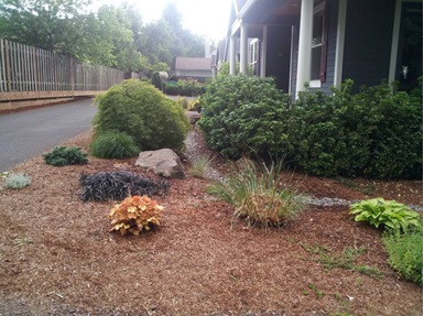
In undeveloped areas, very little rainwater or snowmelt runs off the land like it does in urbanized towns and
cities. Trees, plants, and soil capture much of the precipitation, and some of it evaporates back into the air. Most
of the precipitation that doesn't evaporate or get captured by vegetation soaks into the ground where soil and
microbes remove pollutants naturally. The water slowly recharges streams, wetlands and groundwater. Very
little runs off, except in very large storms. The natural terrain acts like a sponge.
This natural hydrologic cycle is radically altered when land is developed and the way it has been for decades is
changed. Typical development clears the land of vegetation and covers it with hard surfaces such as roads, parking
lots, and rooftops. Construction and foot traffic compact soils, so that even landscaped areas can generate
unnaturally high runoff volumes. Storm drains are installed to get water out of the way by sending it into local
streams or injecting it underground without treatment. Development dramatically increases runoff volumes. Even
when controlled by detention basins, this causes flooding, damages fish and wildlife habitat, and delivers pollutants
such as oils and pesticides to local waterways. The decreased infiltration results in: less cool, clean groundwater
to recharge streams in the dry summer months; and in a reduction in water availability throughout the watershed.
LID practices may be incorporated into existing as well as newly built developments in a community. They
increase groundwater supplies and reduce the negative water quality impacts to streams and fish habitat,
flooding, and in many cases, the cost of stormwater treatment and infrastructure. They are aesthetically pleasing
and have been shown to increase real estate values.
Which BMPs Should I Use, and How?
The 5C Program offers technical guidance on a number of different practices. (See “Navigating the 5C Program’s Stormwater Management Guidance”.) The reason for a particular design element in this guidance may not be apparent immediately; but, it’s “that way” because it supports long-term water quality and watershed restoration . In order for them to work properly, stormwater BMPs must be installed and maintained according to the design specifications. So to avoid unintended consequences, the project team, which might include the owner, designer(s), contractor(s)/construction crew, maintenance staff and others as appropriate, all need to do their part in properly implementing the practices you choose. The table below shows the types of practices that are generally applicable to different stormwater runoff sources. Each BMP has additional applicability criteria related to slopes, soils, setbacks, and geometry and is included in the guidance documents provided by the 5C Program.
Applicability
The following table illustrates which types of stormwater runoff thatseveral BMPs can manage:
|
BMPs |
Stormwater Runoff Surface Types |
|
|
Rooftops |
Roadways |
Sidewalks |
Compacted & Semi-pervious Landscape Areas |
Structural BMP |
Rain Gardens |
X |
X |
X |
X |
Vegetated Filter Strips |
X |
X |
X |
X |
Pervious Concrete |
|
X |
X |
|
Rainwater Harvesting |
X |
|
|
|
Convey Stormwater without a Pipe |
X |
X |
X |
|
Non-structural BMP |
Minimize Impervious Area |
X |
X |
X |
|
Runoff Area Disconnection |
|
X |
X |
|
Tree Preservation & Planting |
|
X |
X |
X |
Restore Soil |
|
|
|
X |
Native Plants |
|
|
|
X |
Combining Practices
Numerous practices may be combined into endless combinations depending on natural conditions on-site, stakeholder and designer preferences, and budget. As you can see, some practices can be applied to runoff from an array of surfaces while others only manage one or two kinds of surfaces. So combining practices is probably the best and most cost-effective way to manage stormwater on your site.
Download/View the 5C Program Stormwater Management Handbook:
Download by Chapters:
For more information, contact us
©2012. Five Counties Salmonid Conservation Program and Green Girl Land Development Solutions. The 5C Program Stormwater Management Handbook may be photocopied or reprinted in its entirety for noncommercial purposes.
Back to Land Use Planning page
Back to Programs Page
| 
